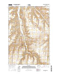
2014 Map of Hickland Butte
USGS Topo · Published 2014About this map
Hickland Butte rises as a prominent landmark in this section of Gilliam County, where the landscape is defined by the deep incisions of Eightmile Canyon and Fourmile Canyon. The map reveals a rural network of roads including Eightmile Rd and Fourmile Rd that navigate the high plateau and canyon floors. Genealogists will find historical interest in the small, localized burial sites of Eightmile Cem and Tommy Dean Cem, reflecting the early settlement patterns and family histories of this high desert region. The transition from t1n r22e to t1s r22e marks the section lines that historically organized land ownership in this part of Oregon. This survey captures a sparse but precisely documented environment where geographic features like Cow Canyon provided essential orientation for early residents and travelers along the Baseline Ln and Mason-Davidson Rd.
Find a feature on this map
18 named features on this map. Tap any name to fly to it.
Don’t see what you’re looking for? This feature index may not catch every label — zoom into the map to look around manually.
Map Details
Editions of this 2014 Hickland Butte Map
This is the sole edition of this map. No revisions or reprints were ever made.
Other maps of this area

1906 · Blalock Island
USGS Topo · 1:125,000

1908 · Blalock Island
USGS Topo · 1:125,000

1916 · Arlington
USGS Topo · 1:125,000

1916 · Condon
USGS Topo · 1:125,000

1953 · Pendleton
USGS Topo · 1:250,000

1953 · The Dalles
USGS Topo · 1:250,000

1956 · The Dalles
USGS Topo · 1:250,000

1956 · Pendleton
USGS Topo · 1:250,000

1957 · The Dalles
USGS Topo · 1:250,000

1964 · Shutler Flat
USGS Topo · 1:24,000