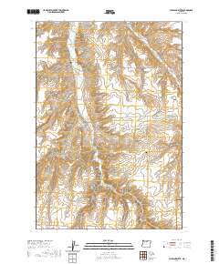
2020 Map of Hickland Butte
USGS Topo · Published 2020About this map
Hickland Butte rises as a prominent landmark in this upland portion of Gilliam County, where the terrain is deeply carved by a network of drainage systems. The landscape is defined by the parallel paths of Eightmile Canyon and Fourmile Canyon, which dictate the local transport network. For genealogists and local historians, the presence of the Eightmile Cem in the north and the Tommy Dean Cem further south provides concrete points of reference for early family settlements in this high plateau region. The map captures the interface of the Gilliam Co Morrow Co line, showing how historical property divisions and roads like Mason Davidson Rd and Ione Rd follow the natural contours of the coulees and plateaus.
Find a feature on this map
20 named features on this map. Tap any name to fly to it.
Don’t see what you’re looking for? This feature index may not catch every label — zoom into the map to look around manually.
Map Details
Editions of this 2020 Hickland Butte Map
This is the sole edition of this map. No revisions or reprints were ever made.
Other maps of this area

1906 · Blalock Island
USGS Topo · 1:125,000

1908 · Blalock Island
USGS Topo · 1:125,000

1916 · Arlington
USGS Topo · 1:125,000

1916 · Condon
USGS Topo · 1:125,000

1953 · Pendleton
USGS Topo · 1:250,000

1953 · The Dalles
USGS Topo · 1:250,000

1956 · The Dalles
USGS Topo · 1:250,000

1956 · Pendleton
USGS Topo · 1:250,000

1957 · The Dalles
USGS Topo · 1:250,000

1964 · Shutler Flat
USGS Topo · 1:24,000