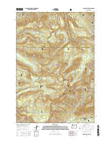
2017 Map of Hickman Butte
USGS Topo · Published 2017About this map
Mount Hood National Forest dominates this landscape, where the headwaters of the Sandy River and Bull Run River drain the high western slopes of the Cascades. The survey illustrates a complex hydrological system critical to the region, featuring Hickman Lake, Goodfellow Lakes, and numerous tributary streams like Blazed Alder Cr and Little Sandy River. While much of the area is defined by peaks such as Hickman Butte and Thimble Mtn, the southeastern corner shows the developed outskirts of Mount Hood Village and the glacial outwash area of Old Maid Flat. A network of Forest Service roads, including Nat For Dev Rd 12 and Lolo Pass Rd, provides the primary access through this timbered terrain. The map serves as a detailed record of the physical geography and forest management infrastructure between the Multnomah and Clackamas county lines.
Find a feature on this map
47 named features on this map. Tap any name to fly to it.
Don’t see what you’re looking for? This feature index may not catch every label — zoom into the map to look around manually.
Map Details
Editions of this 2017 Hickman Butte Map
This is the sole edition of this map. No revisions or reprints were ever made.
Other maps of this area

1916 · Estacada
USGS Topo · 1:125,000

1924 · Mount Hood
USGS Topo · 1:125,000

1926 · Hood River
USGS Topo · 1:125,000

1927 · Mount Hood
USGS Topo · 1:125,000

1929 · Hood River
USGS Topo · 1:125,000

1948 · Vancouver
USGS Topo · 1:250,000

1950 · Vancouver
USGS Topo · 1:250,000

1950 · Vancouver
USGS Topo · 1:250,000

1953 · The Dalles
USGS Topo · 1:250,000

1954 · Bridal Veil
USGS Topo · 1:62,500