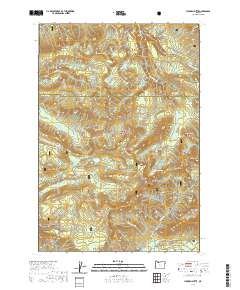
2020 Map of Hickman Butte
USGS Topo · Published 2020About this map
Mount Hood National Forest encompasses this high-elevation terrain along the border of Multnomah and Clackamas counties. The area is defined by its complex drainage network, where the Bull Run River and the Little Sandy River carve through the landscape. Distinctive peaks such as Hickman Butte, Thimble Mtn, and Aschoff Buttes provide significant vertical relief, while high-altitude basins like Township Meadow and Deer Meadows break the forested slopes. The southern portion of the map features the Sandy Wild and Scenic River corridor near Old Maid Flat, highlighting the protected status of these glacial waterways. For those interested in the hydrology of the Cascades, the presence of Goodfellow Lakes and Hickman Lake amidst the ridgelines of Burnt Peak and North Mtn illustrates the high-country water storage systems crucial to the region.
Find a feature on this map
45 named features on this map. Tap any name to fly to it.
Don’t see what you’re looking for? This feature index may not catch every label — zoom into the map to look around manually.
Map Details
Editions of this 2020 Hickman Butte Map
This is the sole edition of this map. No revisions or reprints were ever made.
Other maps of this area

1916 · Estacada
USGS Topo · 1:125,000

1924 · Mount Hood
USGS Topo · 1:125,000

1926 · Hood River
USGS Topo · 1:125,000

1927 · Mount Hood
USGS Topo · 1:125,000

1929 · Hood River
USGS Topo · 1:125,000

1948 · Vancouver
USGS Topo · 1:250,000

1950 · Vancouver
USGS Topo · 1:250,000

1950 · Vancouver
USGS Topo · 1:250,000

1953 · The Dalles
USGS Topo · 1:250,000

1954 · Bridal Veil
USGS Topo · 1:62,500