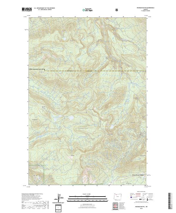
2024 Map of Hickman Butte
USGS Topo · Published 2024About this map
Mount Hood National Forest dominates this section of the Cascade Range, where the high ridgelines of Hickman Butte and Burnt Peak overlook a dense network of mountain drainage. The headwaters of the Bull Run River and the Little Sandy River carve through the landscape, defined by dramatic elevation changes from the lowlands of Old Maid Flat to the summits of Big Bend Mtn and Sugarloaf Mtn. This modern survey illustrates the conservation boundaries of the Mount Hood Wilderness, including the protected corridor of the Sandy Wild and Scenic River. Settlement is concentrated at the edge of the forest in Mount Hood Villages, while the interior remains a landscape of remote meadows and named rock formations like Thunder Rock and the Aschoff Buttes. The mapping of small water bodies such as Hickman Lake and Goodfellow Lakes suggests the hydrological importance of this area to the broader region.
Find a feature on this map
46 named features on this map. Tap any name to fly to it.
Don’t see what you’re looking for? This feature index may not catch every label — zoom into the map to look around manually.
Map Details
Editions of this 2024 Hickman Butte Map
This is the sole edition of this map. No revisions or reprints were ever made.
Other maps of this area

1916 · Estacada
USGS Topo · 1:125,000

1924 · Mount Hood
USGS Topo · 1:125,000

1926 · Hood River
USGS Topo · 1:125,000

1927 · Mount Hood
USGS Topo · 1:125,000

1929 · Hood River
USGS Topo · 1:125,000

1948 · Vancouver
USGS Topo · 1:250,000

1950 · Vancouver
USGS Topo · 1:250,000

1950 · Vancouver
USGS Topo · 1:250,000

1953 · The Dalles
USGS Topo · 1:250,000

1954 · Bridal Veil
USGS Topo · 1:62,500