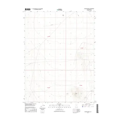
2017 Map of Hickman Knolls
USGS Topo · Published 2017About this map
Skull Valley defines the expansive, arid character of this portion of Tooele County, where the desert landscape is punctuated by isolated topographic rises. The most prominent of these is Hickman Knolls, a cluster of peaks rising from the valley floor in the southeast. This 2017 survey illustrates the sparse human footprint in this high-desert environment, where transportation is limited to a few arterial routes like Waterhole Rd and New Antelope Rd. The map is structured primarily by the Public Land Survey System, showing the intersections of t4s r9w, t4s r8w, t5s r9w, and t5s r8w. The lack of established settlements or industrial infrastructure highlights the region's role as open rangeland or protected desert territory.
Find a feature on this map
8 named features on this map. Tap any name to fly to it.
Don’t see what you’re looking for? This feature index may not catch every label — zoom into the map to look around manually.
Map Details
Editions of this 2017 Hickman Knolls Map
This is the sole edition of this map. No revisions or reprints were ever made.
Other maps of this area

1885 · Tooele Valley
USGS Topo · 1:250,000

1953 · Tooele
USGS Topo · 1:250,000

1955 · Tabbys Peak SE
USGS Topo · 1:24,000

1955 · Tabbys Peak
USGS Topo · 1:24,000

1955 · Timpie
USGS Topo · 1:62,500

1955 · Deseret Peak
USGS Topo · 1:62,500

1955 · Tabbys Peak SW
USGS Topo · 1:24,000

1955 · Tooele
USGS Topo · 1:250,000

1973 · Quincy Spring
USGS Topo · 1:24,000

1973 · Hickman Knolls
USGS Topo · 1:24,000