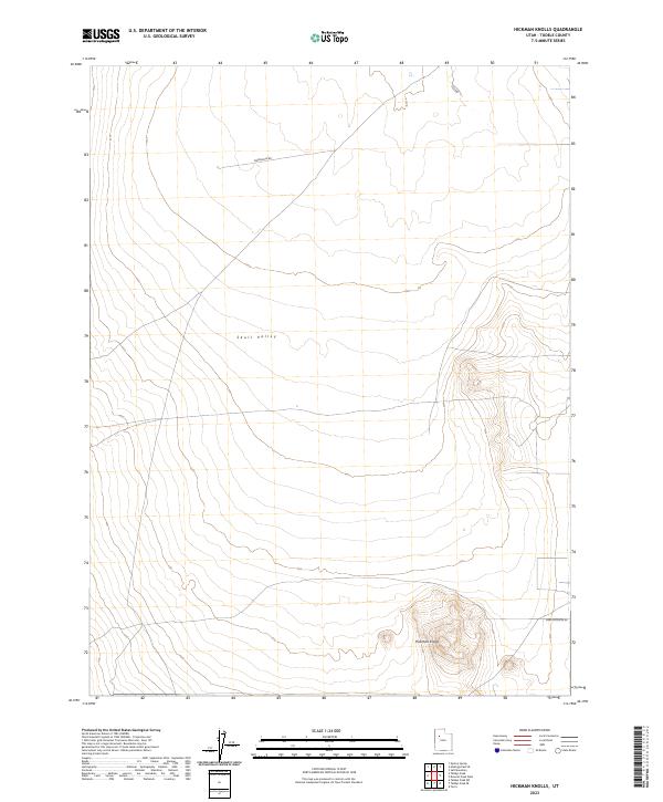
2023 Map of Hickman Knolls
USGS Topo · Published 2023About this map
Skull Valley dominates this Tooele County landscape, a broad desert expanse defined by its subtle drainage patterns and isolated topographic rises. The most prominent landform, the Hickman Knolls, anchors the southeastern portion of the quadrangle, where sharp contour lines indicate a sudden elevation change above the surrounding floor. Human activity is sparsely represented by a network of unimproved desert tracks and local thoroughfares. These include Waterhole Rd crossing the northern flats and New Antelope Rd in the south, suggesting a region primarily utilized for livestock grazing or remote land management. The sparse infrastructure reflects the arid, open character of this part of Utah in the early 21st century.
Find a feature on this map
5 named features on this map. Tap any name to fly to it.
Don’t see what you’re looking for? This feature index may not catch every label — zoom into the map to look around manually.
Map Details
Editions of this 2023 Hickman Knolls Map
This is the sole edition of this map. No revisions or reprints were ever made.
Other maps of this area

1885 · Tooele Valley
USGS Topo · 1:250,000

1953 · Tooele
USGS Topo · 1:250,000

1955 · Tabbys Peak SE
USGS Topo · 1:24,000

1955 · Tabbys Peak
USGS Topo · 1:24,000

1955 · Timpie
USGS Topo · 1:62,500

1955 · Deseret Peak
USGS Topo · 1:62,500

1955 · Tabbys Peak SW
USGS Topo · 1:24,000

1955 · Tooele
USGS Topo · 1:250,000

1973 · Quincy Spring
USGS Topo · 1:24,000

1973 · Hickman Knolls
USGS Topo · 1:24,000