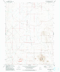
1993 Map of Hickman Knolls
USGS Topo · Published 1993About this map
The Skull Valley Indian Reservation occupies the southeastern reaches of this high desert terrain, dominated by the prominent elevations of the Hickman Knolls. Surveyed in the late 20th century, the landscape is defined by the broad expanse of Skull Valley, a region characterized by sparse water sources like Hatch Well. The map captures a network of 4wd tracks and unimproved roads, reflecting the land's primary use for transit and resource management rather than dense settlement. This 1993 edition, updated from earlier aerial photography, offers a precise look at the township and range boundaries of R 9 W and R 8 W, detailing the topography of the valley floor before it rises into the eastern foothills.
Find a feature on this map
6 named features on this map. Tap any name to fly to it.
Don’t see what you’re looking for? This feature index may not catch every label — zoom into the map to look around manually.
Map Details
Editions of this 1993 Hickman Knolls Map
This is the sole edition of this map. No revisions or reprints were ever made.
Other maps of this area

1885 · Tooele Valley
USGS Topo · 1:250,000

1953 · Tooele
USGS Topo · 1:250,000

1955 · Tabbys Peak SE
USGS Topo · 1:24,000

1955 · Tabbys Peak
USGS Topo · 1:24,000

1955 · Timpie
USGS Topo · 1:62,500

1955 · Deseret Peak
USGS Topo · 1:62,500

1955 · Tabbys Peak SW
USGS Topo · 1:24,000

1955 · Tooele
USGS Topo · 1:250,000

1973 · Quincy Spring
USGS Topo · 1:24,000

1973 · Hickman Knolls
USGS Topo · 1:24,000