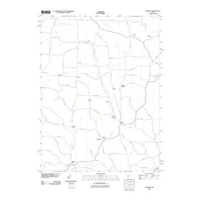
2010 Map of Hickman
USGS Topo · Published 2010About this map
Rocky Fork and its various branches, including the East Branch Rocky Fork, define the drainage and settlement patterns across this Licking County landscape. Small rural communities like Hickman and Purity are centers for local activity, surrounded by a network of winding roads such as Purity Rd and Baker Rd. The area is notably dense with organized outdoor spaces, featuring Camp Ohio, Falling Rock Camp, and Camp Wakatomika, which suggest a long-standing tradition of youth and community recreation in the wooded valleys. Family and community heritage is preserved in numerous burial grounds, including the Eden Church Cemetery, Souslin Cemetery, and Miles Chapel Cemetery. To the south, Wilkins Run sits near the confluence of several small streams like Smokyrow Run, highlighting the intricate hydrology that shaped early local homesteads and travel routes.
Find a feature on this map
80 named features on this map. Tap any name to fly to it.
Don’t see what you’re looking for? This feature index may not catch every label — zoom into the map to look around manually.
Map Details
Editions of this 2010 Hickman Map
This is the sole edition of this map. No revisions or reprints were ever made.
Other maps of this area

1909 · Newark
USGS Topo · 1:62,500

1910 · Frazeysburg
USGS Topo · 1:62,500

1912 · Gambier
USGS Topo · 1:62,500

1913 · Brinkhaven
USGS Topo · 1:62,500

1914 · Gambier
USGS Topo · 1:62,500

1915 · Brinkhaven
USGS Topo · 1:62,500

1943 · Gambier
USGS Topo · 1:62,500

1950 · Marion
USGS Topo · 1:250,000

1961 · Hanover
USGS Topo · 1:24,000

1961 · Newark
USGS Topo · 1:24,000