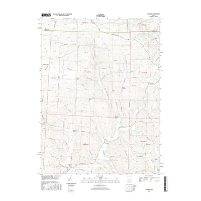
2016 Map of Hickman
USGS Topo · Published 2016About this map
The Rocky Fork and its various tributaries, including the E Br Rocky Fork, define the topography of this Licking County landscape. Small rural hubs such as Hickman and Purity are connected by a dense network of township and county roads, including the historical corridor of Martinsburg Rd crossing the Knox County line. The map is particularly useful for genealogical research, documenting several distinct burial grounds like Souslin Cem, Rocky Fork Cem, and the Barnes Cem near Wilkins Run. Notable landmarks like the Boy Scout Memorial Bridge across the fork and the small waters of Lake Otto suggest a landscape used for both agriculture and local recreation. In the southeastern corner, the settlement of Reform sits near the headwaters of Painter Run, illustrating the persistent small-town settlement patterns that have remained in this part of Ohio into the twenty-first century.
Find a feature on this map
127 named features on this map. Tap any name to fly to it.
Don’t see what you’re looking for? This feature index may not catch every label — zoom into the map to look around manually.
Map Details
Editions of this 2016 Hickman Map
This is the sole edition of this map. No revisions or reprints were ever made.
Other maps of this area

1909 · Newark
USGS Topo · 1:62,500

1910 · Frazeysburg
USGS Topo · 1:62,500

1912 · Gambier
USGS Topo · 1:62,500

1913 · Brinkhaven
USGS Topo · 1:62,500

1914 · Gambier
USGS Topo · 1:62,500

1915 · Brinkhaven
USGS Topo · 1:62,500

1943 · Gambier
USGS Topo · 1:62,500

1950 · Marion
USGS Topo · 1:250,000

1961 · Hanover
USGS Topo · 1:24,000

1961 · Newark
USGS Topo · 1:24,000