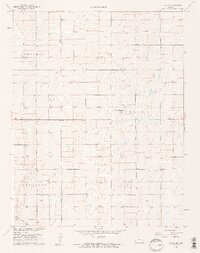
1960 Map of Hickok SE
USGS Topo · Published 1961About this map
The boundary between Grant Co and Haskell Co divides this landscape, where the natural prairie of western Kansas is systematically overlaid with the grid of the petroleum industry. Surveyed in the late 1950s, the terrain is characterized by numerous depressions and draws, punctuated almost everywhere by the Gas Wells that define the local economy. The townships of Sherman, Eubank, Dudley, and Sullivan meet here, showing a sparsely populated agricultural region where infrastructure is focused on resource extraction. Aside from the industrial footprint, human presence is marked by small, localized landmarks like the Canaan Cem and a prominent Radio Tower, which stood as essential navigational and community points in an otherwise open, repeating landscape.
Find a feature on this map
8 named features on this map. Tap any name to fly to it.
Don’t see what you’re looking for? This feature index may not catch every label — zoom into the map to look around manually.
Map Details
Editions of this 1960 Hickok SE Map
2 editions found

Other maps of this area

1891 · Larned
USGS Topo · 1:125,000

1896 · Garden
USGS Topo · 1:125,000

1900 · Lakin
USGS Topo · 1:125,000

1944 · Moscow
USGS Topo · 1:62,500

1945 · Moscow
USGS Topo · 1:62,500

1955 · Dodge City
USGS Topo · 1:250,000

1958 · Dodge City
USGS Topo · 1:250,000

1959 · Dodge City
USGS Topo · 1:250,000

1959 · Hickok NW
USGS Topo · 1:24,000

1959 · Hickok
USGS Topo · 1:24,000