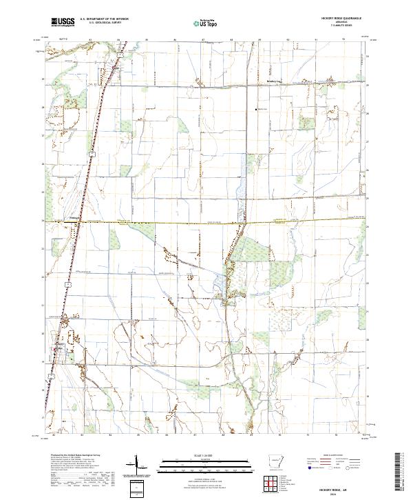
2024 Map of Hickory Ridge
USGS Topo · Published 2024About this map
Hickory Ridge and Fisher anchor the western edge of this agricultural corridor, where the land patterns of Cross and Poinsett Counties meet. The landscape is defined by its drainage network, ranging from natural meandering systems like Overcup Creek and Gum Slough to the engineered precision of Ditch Number 15. The intersection of Pittinger sits along the rail line, representing the small-scale settlement nodes that once supported the surrounding Delta farmland.
Find a feature on this map
57 named features on this map. Tap any name to fly to it.
Don’t see what you’re looking for? This feature index may not catch every label — zoom into the map to look around manually.
Map Details
Editions of this 2024 Hickory Ridge Map
This is the sole edition of this map. No revisions or reprints were ever made.
Other maps of this area

1935 · Tuckerman
USGS Topo · 1:62,500

1939 · Vanndale
USGS Topo · 1:62,500

1939 · Weiner
USGS Topo · 1:62,500

1940 · Tilton
USGS Topo · 1:62,500

1953 · Memphis
USGS Topo · 1:250,000

1956 · Memphis
USGS Topo · 1:250,000

1956 · Tilton
USGS Topo · 1:62,500

1958 · Vanndale
USGS Topo · 1:62,500

1959 · Weiner
USGS Topo · 1:62,500

1960 · Weiner
USGS Topo · 1:62,500