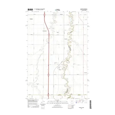
2014 Map of Hickson
USGS Topo · Published 2014About this map
Red River of the North winds along the border of North Dakota and Minnesota, creating a deeply meandered corridor that defines the geography south of Fargo. This agricultural landscape is anchored by small communities and transit links, including the settlement of Hickson and the rural parish area of Saint Benedict. The map reveals a high density of burial grounds relative to its population centers, such as Lower Wild Rice and Red River Cem and North Pleasant Cem, reflecting the deep-rooted family histories of the Red River Valley. The presence of Ellig Field Airport and the complex drainage of the Wild Rice River and Wolverton Cr illustrate how the modern infrastructure of Cass and Clay counties must navigate the ancient, shifting floodplains of this river system.
Find a feature on this map
46 named features on this map. Tap any name to fly to it.
Don’t see what you’re looking for? This feature index may not catch every label — zoom into the map to look around manually.
Map Details
Editions of this 2014 Hickson Map
This is the sole edition of this map. No revisions or reprints were ever made.
Other maps of this area

1895 · Fargo
USGS Topo · 1:125,000

1897 · Fargo
USGS Topo · 1:125,000

1953 · Fargo
USGS Topo · 1:250,000

1956 · Fargo
USGS Topo · 1:250,000

1959 · South West Fargo
USGS Topo · 1:24,000

1959 · Fargo South
USGS Topo · 1:24,000

1959 · Hickson
USGS Topo · 1:24,000
1959 · Walcott
USGS Topo · 1:24,000

1959 · Christine
USGS Topo · 1:24,000
1959 · Norman
USGS Topo · 1:24,000