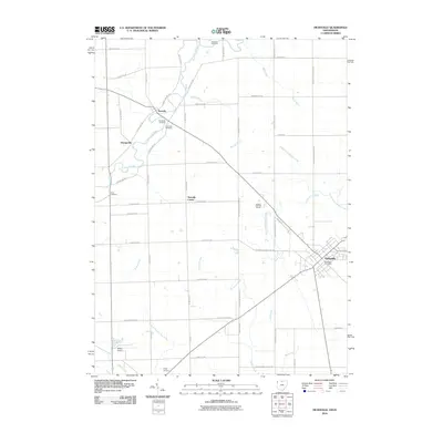
2010 Map of Hicksville
USGS Topo · Published 2010About this map
The Saint Joseph River meanders across the northwestern corner of this quadrangle, defining the local landscape near the settlements of Newville and Orangeville. This borderland region between Ohio and Indiana is characterized by a dense network of agricultural drainage systems, including Melissa Ditch, Tustison Creek, and Hook Ditch, which support the surrounding rural landscape. The town of Hicksville serves as the primary hub in the southeast, featuring the Hicksville Post Office and an organized street grid that contrasts with the long, straight county roads of the outlying townships.
Find a feature on this map
54 named features on this map. Tap any name to fly to it.
Don’t see what you’re looking for? This feature index may not catch every label — zoom into the map to look around manually.
Map Details
Editions of this 2010 Hicksville Map
This is the sole edition of this map. No revisions or reprints were ever made.
Other maps of this area

1914 · Bryan
USGS Topo · 1:62,500

1914 · Paulding
USGS Topo · 1:62,500

1943 · Bryan
USGS Topo · 1:62,500

1944 · Paulding
USGS Topo · 1:62,500

1953 · Fort Wayne
USGS Topo · 1:250,000

1956 · Fort Wayne
USGS Topo · 1:250,000

1958 · Hicksville
USGS Topo · 1:24,000

1958 · Grabill
USGS Topo · 1:24,000

1958 · Butler West
USGS Topo · 1:24,000

1958 · Woodburn North
USGS Topo · 1:24,000