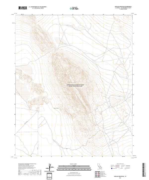
2021 Map of Hidalgo Mountain
USGS Topo · Published 2021About this map
Hidalgo Mtn dominates the central landscape of this 2021 survey, standing as a prominent landmark within the high plains of the Mojave Desert. The map details a largely unpopulated desert terrain where transportation is limited to a few specific routes, including Creole Mine Rd in the west and Mesa Rd further south. This area is defined by its township and range grid, where the intersection of t4n r6e and t4n r7e marks a vast expanse of alluvial fans and mountain slopes. The lack of modern residential or commercial settlements suggests a landscape still largely shaped by geological features and sparse access roads typical of remote San Bernardino County.
Find a feature on this map
10 named features on this map. Tap any name to fly to it.
Don’t see what you’re looking for? This feature index may not catch every label — zoom into the map to look around manually.
Map Details
Editions of this 2021 Hidalgo Mountain Map
This is the sole edition of this map. No revisions or reprints were ever made.
Other maps of this area

1953 · San Bernardino
USGS Topo · 1:250,000

1954 · Galway Lake
USGS Topo · 1:24,000

1954 · Hidalgo Mtn
USGS Topo · 1:24,000

1954 · Emerson Lake
USGS Topo · 1:24,000

1955 · Deadman Lake NW
USGS Topo · 1:24,000

1955 · Lavic SE
USGS Topo · 1:24,000

1955 · Goat Mountain
USGS Topo · 1:24,000

1955 · Morgans Well
USGS Topo · 1:24,000

1955 · Deadman Lake SW
USGS Topo · 1:24,000

1955 · Lavic
USGS Topo · 1:62,500