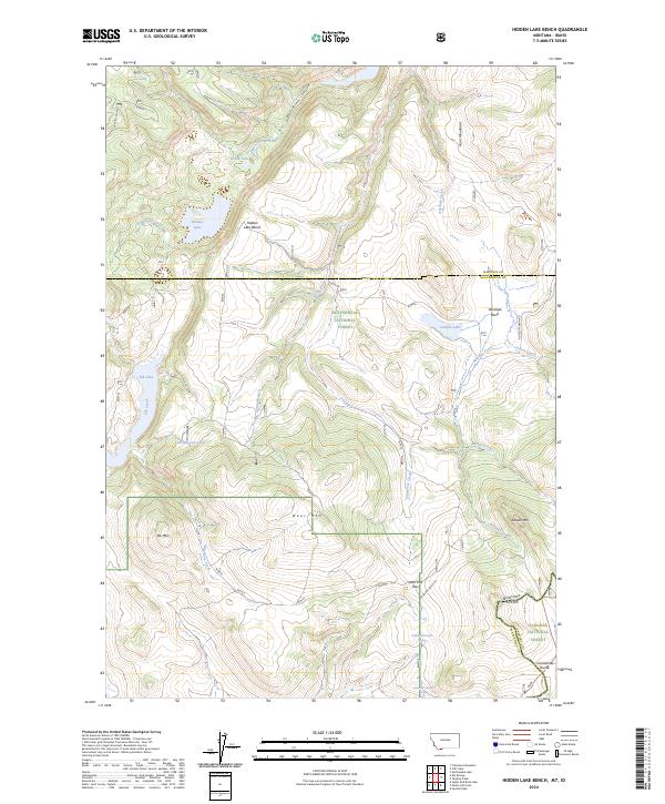
2024 Map of Hidden Lake Bench
USGS Topo · Published 2024About this map
Beaverhead National Forest and Targhee National Forest converge at the Continental Divide in this high-altitude corner of Southwest Montana. The terrain is defined by a dense network of mountain hydrology, including the eponymous Hidden Lake Bench and the waters of Elk Lake. To the south, the Red Rock Lakes National Wildlife Refuge marks a significant conservation boundary, while the surrounding peaks like Saddle Mtn and Deer Mtn overlook a landscape carved by Lost Mine Canyon and Brimstone Creek. Remote routes such as Antelope Basin Rd provide limited access to the high basins, where seasonal springs like Lost Spring and 13S01E28AACD01 Spring support the local ecosystem. This 2024 survey documents a rugged wilderness where the Madison and Beaverhead county lines meet amidst the Horn Mountains.
Find a feature on this map
40 named features on this map. Tap any name to fly to it.
Don’t see what you’re looking for? This feature index may not catch every label — zoom into the map to look around manually.
Map Details
Editions of this 2024 Hidden Lake Bench Map
This is the sole edition of this map. No revisions or reprints were ever made.
Other maps of this area

1950 · Cliff Lake
USGS Topo · 1:62,500

1950 · Hebgen Dam
USGS Topo · 1:62,500

1950 · Upper Red Rock Lake
USGS Topo · 1:62,500

1955 · Ashton
USGS Topo · 1:250,000

1958 · Ashton
USGS Topo · 1:250,000

1960 · Ashton
USGS Topo · 1:250,000

1964 · Targhee Peak
USGS Topo · 1:24,000

1964 · Sawtell PK
USGS Topo · 1:24,000

1964 · Henrys Lake
USGS Topo · 1:62,500
1988 · Hidden Lake Bench
USGS Topo · 1:24,000