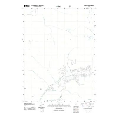
2011 Map of Hidden Lake
USGS Topo · Published 2011About this map
Weber River and the South Fork Weber River converge in this high-altitude corner of the Wasatch Range, where early 21st-century residential developments like those along Canyon Rim Rd and Conifer Dr intersect with long-established natural landmarks. The drainage patterns of Smith and Morehouse Creek and Stillman Creek define the eastern terrain, while the namesake Hidden Lake lies tucked into the southwest near the base of Mahogany Hills. The road network carries names of western explorers, including Jim Bridger, Fremont, and Lewis and Clark, reflecting a modern thematic overlay on a landscape characterized by deep basins and drainages such as Whites Basin and Frazier Hollow. This survey captures the area before more recent expansion, showing a specific balance between seasonal wilderness and permanent mountain access.
Find a feature on this map
29 named features on this map. Tap any name to fly to it.
Don’t see what you’re looking for? This feature index may not catch every label — zoom into the map to look around manually.
Map Details
Editions of this 2011 Hidden Lake Map
This is the sole edition of this map. No revisions or reprints were ever made.
Other maps of this area

1885 · Salt Lake
USGS Topo · 1:250,000

1900 · Coalville
USGS Topo · 1:125,000

1903 · Coalville
USGS Topo · 1:125,000

1954 · Salt Lake City
USGS Topo · 1:250,000

1958 · Salt Lake City
USGS Topo · 1:250,000

1960 · Salt Lake City
USGS Topo · 1:250,000
1967 · Turner Hollow
USGS Topo · 1:24,000

1967 · Kamas
USGS Topo · 1:24,000
1967 · Upton
USGS Topo · 1:24,000
1967 · Crandall Canyon
USGS Topo · 1:24,000