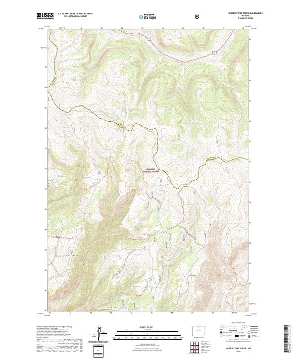
2021 Map of Hidden Tepee Creek
USGS Topo · Published 2021About this map
Bighorn National Forest dominates this high-altitude landscape along the border of Sheridan and Big Horn counties. The terrain is defined by a series of dramatic mesas and intricate drainage systems, most notably Horse Creek Mesa and Sunlight Mesa in the southern half of the quadrangle. These flat-topped elevations are separated by deep-cut watercourses such as Horse Cr and Cottonwood Cr, while the northern region is shaped by the N Tongue River valley. A dense network of primitive trails and pack routes, including the Elkhorn Trl, Torry Gulch Trl, and Cottonwood Creek Trl, suggests a region managed for timber, grazing, and backcountry access rather than permanent settlement. Vital water sources like Whedon Spring and Deer Spring provide essential landmarks in an area where the topography is the primary influence on movement and land use.
Find a feature on this map
40 named features on this map. Tap any name to fly to it.
Don’t see what you’re looking for? This feature index may not catch every label — zoom into the map to look around manually.
Map Details
Editions of this 2021 Hidden Tepee Creek Map
This is the sole edition of this map. No revisions or reprints were ever made.
Other maps of this area

1898 · Bald Mountain
USGS Topo · 1:125,000

1901 · Bald Mountain
USGS Topo · 1:125,000

1955 · Sheridan
USGS Topo · 1:250,000

1958 · Sheridan
USGS Topo · 1:250,000

1960 · Shell Falls
USGS Topo · 1:24,000

1960 · Black Mountain
USGS Topo · 1:24,000

1960 · Granite Pass
USGS Topo · 1:24,000

1960 · Hidden Tepee Creek
USGS Topo · 1:24,000

1960 · Shell
USGS Topo · 1:24,000
1960 · Bald Mountain
USGS Topo · 1:24,000