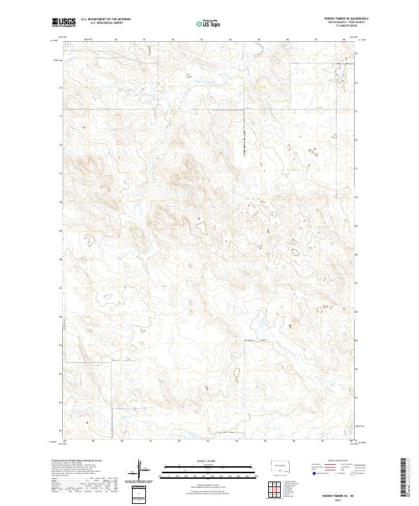
2021 Map of Hidden Timber SE
USGS Topo · Published 2021About this map
Eagle Cr and Sand Cr define the drainage patterns of this Todd County landscape, where the terrain transitions through a series of prairie draws and plateaus. Located in the northern reaches of the Rosebud Indian Reservation, the area is gridded by the Public Land Survey System into townships including t36n r26w and t35n r25w. Transport in this part of South Dakota is sparse, relying on rural routes like Little Burg Rd and C R 125 to navigate the open country. The map provides a clear look at the modern rural infrastructure and land divisions in a region characterized by its expansive watercourses and topographic relief.
Find a feature on this map
8 named features on this map. Tap any name to fly to it.
Don’t see what you’re looking for? This feature index may not catch every label — zoom into the map to look around manually.
Map Details
Editions of this 2021 Hidden Timber SE Map
This is the sole edition of this map. No revisions or reprints were ever made.
Other maps of this area

1950 · Norden
USGS Topo · 1:62,500

1950 · Sparks
USGS Topo · 1:62,500

1952 · Norden
USGS Topo · 1:62,500

1955 · Martin
USGS Topo · 1:250,000

1957 · Valentine
USGS Topo · 1:250,000

1958 · Martin
USGS Topo · 1:250,000

1959 · Valentine
USGS Topo · 1:250,000

1982 · Hidden Timber
USGS Topo · 1:24,000

1982 · Hidden Timber SE
USGS Topo · 1:24,000
1982 · Keyapaha NW
USGS Topo · 1:24,000