
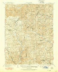
1910 Map of Higdon
USGS Topo · Published 1910About this map
St Michael Mountain and the ridges of the St Francois Mountains dominate this early twentieth-century survey of the rugged Missouri Ozarks. At the convergence of Perry, Bollinger, St. Francois, and Madison counties, the landscape is defined by a dense network of upland schools and water-powered industries. Local commerce is centered on sites like Nations Mill, Hahns Mill, and Heitmans Mill, which utilized the descent of the Castor River and Whitewater Creek. Small rural communities such as Higdon, Womack, and Patton serve as anchors for a network of early roads, including the Ste Genevieve and Ironton Road. The map provides a detailed view of the social fabric of the era, marking numerous rural institutions like the Bandenstistle School and Silver Point Church that supported these dispersed farming and milling families.
Find a feature on this map
73 named features on this map. Tap any name to fly to it.
Don’t see what you’re looking for? This feature index may not catch every label — zoom into the map to look around manually.
Map Details
Editions of this 1910 Higdon Map
2 editions found
Other maps of this area

1904 · Farmington
USGS Topo · 1:62,500

1906 · Farmington
USGS Topo · 1:62,500

1907 · Weingarten
USGS Topo · 1:62,500

1909 · Weingarten
USGS Topo · 1:62,500

1915 · Chester
USGS Topo · 1:62,500

1923 · Perryville
USGS Topo · 1:62,500

1924 · Perryville
USGS Topo · 1:62,500

1930 · Coldwater
USGS Topo · 1:62,500

1933 · Marble Hill
USGS Topo · 1:62,500

1933 · Marquand
USGS Topo · 1:62,500