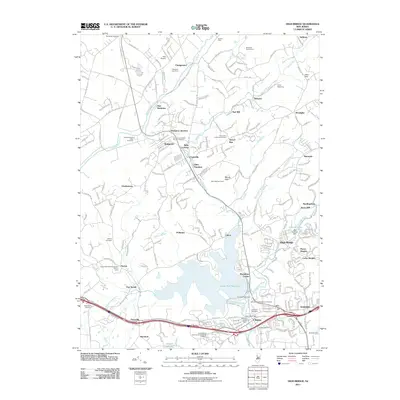
2011 Map of High Bridge
USGS Topo · Published 2011About this map
The Musconetcong River and South Branch Raritan River valleys define this 2011 survey, illustrating a landscape where industrial heritage and water management converge. Large-scale infrastructure dominates the central terrain, notably the expansive Spruce Run Reservoir and the Lake Solitude Dam. These water bodies are flanked by established settlements such as High Bridge, Clinton, and Hampton, reflecting a long history of river-based commerce.
Find a feature on this map
192 named features on this map. Tap any name to fly to it.
Don’t see what you’re looking for? This feature index may not catch every label — zoom into the map to look around manually.
Map Details
Editions of this 2011 High Bridge Map
This is the sole edition of this map. No revisions or reprints were ever made.
Other maps of this area

1888 · Hackettstown
USGS Topo · 1:62,500

1890 · Easton
USGS Topo · 1:62,500

1890 · High Bridge
USGS Topo · 1:62,500

1891 · Easton
USGS Topo · 1:62,500

1891 · Delaware Water Gap
USGS Topo · 1:62,500

1893 · Delaware Water Gap
USGS Topo · 1:62,500

1894 · Hackettstown
USGS Topo · 1:62,500

1898 · Hackettstown
USGS Topo · 1:62,500

1898 · High Bridge
USGS Topo · 1:62,500

1900 · Raritan
USGS Topo · 1:125,000