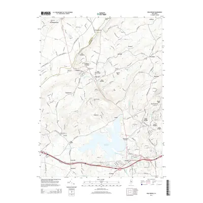
2014 Map of High Bridge
USGS Topo · Published 2014About this map
Spruce Run Reservoir dominates the heart of the central New Jersey landscape, separating the rugged elevations of Musconetcong Mtn from the developed corridors of the S Br Raritan River. This topographical study illustrates a region defined by its varied settlement patterns, from the industrial character of High Bridge and Clinton in the south to the higher-elevation rural hamlets like Woodglen and Anthony in the north. Genealogists can find numerous historical burial sites, including the Saint Anns Catholic Church Cem near Hampton Junction and the Norton Methodist Episcopal Church Yard. The convergence of transportation and industry is evident where the Musconetcong River cuts through the valley, passing through historic hubs like Changewater and New Hampton. The presence of small aviation sites such as Vliet Airport and recreational features like Lake Solitude underscore the modern land use transitions in Warren and Hunterdon counties.
Find a feature on this map
66 named features on this map. Tap any name to fly to it.
Don’t see what you’re looking for? This feature index may not catch every label — zoom into the map to look around manually.
Map Details
Editions of this 2014 High Bridge Map
This is the sole edition of this map. No revisions or reprints were ever made.
Other maps of this area

1888 · Hackettstown
USGS Topo · 1:62,500

1890 · Easton
USGS Topo · 1:62,500

1890 · High Bridge
USGS Topo · 1:62,500

1891 · Easton
USGS Topo · 1:62,500

1891 · Delaware Water Gap
USGS Topo · 1:62,500

1893 · Delaware Water Gap
USGS Topo · 1:62,500

1894 · Hackettstown
USGS Topo · 1:62,500

1898 · Hackettstown
USGS Topo · 1:62,500

1898 · High Bridge
USGS Topo · 1:62,500

1900 · Raritan
USGS Topo · 1:125,000