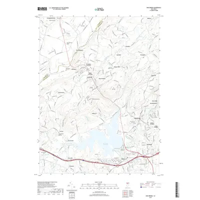
2019 Map of High Bridge
USGS Topo · Published 2019About this map
Spruce Run Reservoir dominates the center of this Hunterdon County landscape, a massive water feature that dramatically altered the local hydrology south of Glen Gardner. The terrain is defined by the parallel ridges of Pohatcong Mtn and Musconetcong Mtn, with the Musconetcong River carving through the valley between them. This area serves as a significant transport and settlement corridor, where the historic communities of Hampton and High Bridge developed near rail junctions and river crossings. Detailed church and cemetery records are well-represented, including the Norton Methodist Churchyard and the Spruce Run Lutheran Cem. Farther south, the town of Clinton sits at the confluence of Mulhockaway Creek and the South Branch Raritan River, illustrating the importance of water power and valley floor navigation in New Jersey's upland geography.
Find a feature on this map
60 named features on this map. Tap any name to fly to it.
Don’t see what you’re looking for? This feature index may not catch every label — zoom into the map to look around manually.
Map Details
Editions of this 2019 High Bridge Map
This is the sole edition of this map. No revisions or reprints were ever made.
Other maps of this area

1888 · Hackettstown
USGS Topo · 1:62,500

1890 · Easton
USGS Topo · 1:62,500

1890 · High Bridge
USGS Topo · 1:62,500

1891 · Easton
USGS Topo · 1:62,500

1891 · Delaware Water Gap
USGS Topo · 1:62,500

1893 · Delaware Water Gap
USGS Topo · 1:62,500

1894 · Hackettstown
USGS Topo · 1:62,500

1898 · Hackettstown
USGS Topo · 1:62,500

1898 · High Bridge
USGS Topo · 1:62,500

1900 · Raritan
USGS Topo · 1:125,000