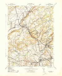
1943 Map of High Bridge
USGS Topo · Published 1943About this map
The Musconetcong River and its valley serve as the industrial and transit spine of this wartime Hunterdon County landscape. Significant early 1940s infrastructure is visible, including the Asbury Graphite Refinery and the Tidewater Tank Farm near Changewater. The map documents a critical era for public institutions, showing the sprawling grounds of the NJ State Hospital and the NJ State Reformatory. Railroad dominance is evident where the Delaware Lackawanna and Western Railroad and Central Railroad of New Jersey converge at Hampton Junction. The township of High Bridge centers on Solitude Lake and the South Branch Raritan River, while civic life is anchored by locations like St Anne Church, the Clinton H School, and several rural schoolhouses in outlying hamlets like Bunnvale.
Find a feature on this map
61 named features on this map. Tap any name to fly to it.
Don’t see what you’re looking for? This feature index may not catch every label — zoom into the map to look around manually.
Map Details
Editions of this 1943 High Bridge Map
This is the sole edition of this map. No revisions or reprints were ever made.
Other maps of this area

1888 · Hackettstown
USGS Topo · 1:62,500

1890 · Easton
USGS Topo · 1:62,500

1890 · High Bridge
USGS Topo · 1:62,500

1891 · Easton
USGS Topo · 1:62,500

1891 · Delaware Water Gap
USGS Topo · 1:62,500

1893 · Delaware Water Gap
USGS Topo · 1:62,500

1894 · Hackettstown
USGS Topo · 1:62,500

1898 · Hackettstown
USGS Topo · 1:62,500

1898 · High Bridge
USGS Topo · 1:62,500

1900 · Raritan
USGS Topo · 1:125,000