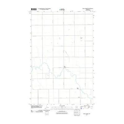
2010 Map of High Landing
USGS Topo · Published 2010About this map
The Red Lake River meanders sharply through the heart of this Pennington County landscape, providing the primary geographical feature of the area. The small settlement of High Landing is positioned at a key bend in the river, where several rural routes including County Hwy-58 and County Hwy-5 converge. To the southeast, the River Valley area sits near the riverbanks, while the rural interior is marked by the presence of Oak Park Cemetery and the Swanson Airport. The mapping reveals a distinct grid of agricultural roads, such as County Hwy-62 and County Hwy-94, which facilitate movement between these quiet riverside communities and the surrounding farmland.
Find a feature on this map
28 named features on this map. Tap any name to fly to it.
Don’t see what you’re looking for? This feature index may not catch every label — zoom into the map to look around manually.
Map Details
Editions of this 2010 High Landing Map
This is the sole edition of this map. No revisions or reprints were ever made.
Other maps of this area

1919 · Grit
USGS Topo · 1:62,500

1919 · Winsor
USGS Topo · 1:62,500

1954 · Bemidji
USGS Topo · 1:250,000

1954 · Roseau
USGS Topo · 1:250,000

1957 · Roseau
USGS Topo · 1:250,000

1957 · Bemidji
USGS Topo · 1:250,000

1958 · Bemidji
USGS Topo · 1:250,000

1958 · Roseau
USGS Topo · 1:250,000
1971 · Roland
USGS Topo · 1:24,000

1972 · Erie
USGS Topo · 1:24,000