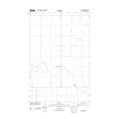
2013 Map of High Landing
USGS Topo · Published 2013About this map
Red Lake River meanders sharply across the Pennington County landscape, defining the character of the High Landing and River Valley area. This 2013 topographic survey captures the organized grid of rural roads and drainage infrastructure, such as County Ditch Number Thirtynine A, which supported the region's agricultural development. The map reveals the local infrastructure including the Swanson Private Airport and the intersection of MN-1 and MN-222. Genealogists will find the location of Oak Park Cem in the southern portion of the sheet, providing a vital point of reference for family history research in this part of northern Minnesota.
Find a feature on this map
17 named features on this map. Tap any name to fly to it.
Don’t see what you’re looking for? This feature index may not catch every label — zoom into the map to look around manually.
Map Details
Editions of this 2013 High Landing Map
This is the sole edition of this map. No revisions or reprints were ever made.
Other maps of this area

1919 · Grit
USGS Topo · 1:62,500

1919 · Winsor
USGS Topo · 1:62,500

1954 · Bemidji
USGS Topo · 1:250,000

1954 · Roseau
USGS Topo · 1:250,000

1957 · Roseau
USGS Topo · 1:250,000

1957 · Bemidji
USGS Topo · 1:250,000

1958 · Bemidji
USGS Topo · 1:250,000

1958 · Roseau
USGS Topo · 1:250,000
1971 · Roland
USGS Topo · 1:24,000

1972 · Erie
USGS Topo · 1:24,000