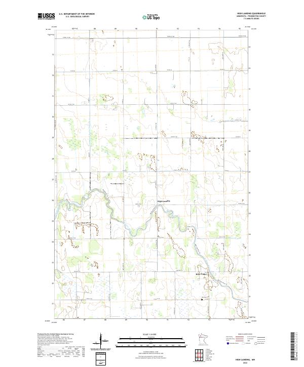
2022 Map of High Landing
USGS Topo · Published 2022About this map
Red Lake River meanders through the center of this Pennington County landscape, defining the character of the small settlements at High Landing and River Valley. The terrain is characterized by a high density of wetlands and complex drainage patterns, managed by man-made infrastructure like the County Ditch Number Thirtynine A to the west. Local travel is facilitated by a grid of rural roads and the Red Lake River Trl, which follows the river's northern bank as it winds toward the eastern edge of the survey. In the south, Oak Park Cem provides a quiet landmark near the junction of Co Rd 25, serving the surrounding agricultural community. This map illustrates the intersection of natural riverine environments and the structured township and range system that organized this part of northern Minnesota.
Find a feature on this map
24 named features on this map. Tap any name to fly to it.
Don’t see what you’re looking for? This feature index may not catch every label — zoom into the map to look around manually.
Map Details
Editions of this 2022 High Landing Map
This is the sole edition of this map. No revisions or reprints were ever made.
Other maps of this area

1919 · Grit
USGS Topo · 1:62,500

1919 · Winsor
USGS Topo · 1:62,500

1954 · Bemidji
USGS Topo · 1:250,000

1954 · Roseau
USGS Topo · 1:250,000

1957 · Roseau
USGS Topo · 1:250,000

1957 · Bemidji
USGS Topo · 1:250,000

1958 · Bemidji
USGS Topo · 1:250,000

1958 · Roseau
USGS Topo · 1:250,000
1971 · Roland
USGS Topo · 1:24,000

1972 · Erie
USGS Topo · 1:24,000