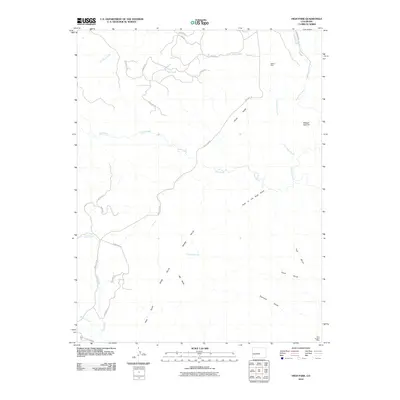
2010 Map of High Park
USGS Topo · Published 2010About this map
Bare Hills dominate the topography of this Fremont County landscape, where the high-altitude terrain is marked by a network of seasonal drainages and mining history. The northern reaches are defined by the Albany Mine and the prominent Booger Red Hill, while the southeastern corner reveals the Blue Nugget Mine near the headwaters of Trail Gulch. The road network, including High Park Rd and several routes named for Indigenous peoples like Cherokee Rd and Apache Rd, suggests a region of modern residential or recreational access into the high country. Water sources such as Sheep Springs and the confluence of City Creek and Wilson Creek provide critical points of interest in an otherwise arid and dissected landscape. The map captures a transition where traditional extraction sites like Albany Mine sit alongside developing rural corridors.
Find a feature on this map
31 named features on this map. Tap any name to fly to it.
Don’t see what you’re looking for? This feature index may not catch every label — zoom into the map to look around manually.
Map Details
Editions of this 2010 High Park Map
This is the sole edition of this map. No revisions or reprints were ever made.
Other maps of this area

1894 · Pikes Peak
USGS Topo · 1:125,000

1901 · Pikes Peak
USGS Topo · 1:125,000

1901 · Pikes Peak
USGS Topo · 1:62,500

1942 · Cover Mtn.
USGS Topo · 1:62,500

1948 · Cover Mtn.
USGS Topo · 1:62,500

1951 · Cripple Creek South
USGS Topo · 1:24,000

1951 · Cripple Creek North
USGS Topo · 1:24,000

1954 · Cooper Mountain
USGS Topo · 1:24,000

1954 · Pueblo
USGS Topo · 1:250,000

1957 · Pueblo
USGS Topo · 1:250,000