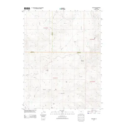
2013 Map of High Park
USGS Topo · Published 2013About this map
Bare Hills City and the surrounding high-altitude drainage systems of central Colorado are the primary focus of this 2013 topographic study. The landscape is defined by the convergence of Park, Teller, and Fremont counties, where significant vertical relief is carved by watercourses like High Cr and Fourmile Cr. The settlement patterns here are sparse, centered around the High Park area and the small grouping at Bare Hills.
Find a feature on this map
41 named features on this map. Tap any name to fly to it.
Don’t see what you’re looking for? This feature index may not catch every label — zoom into the map to look around manually.
Map Details
Editions of this 2013 High Park Map
This is the sole edition of this map. No revisions or reprints were ever made.
Other maps of this area

1894 · Pikes Peak
USGS Topo · 1:125,000

1901 · Pikes Peak
USGS Topo · 1:125,000

1901 · Pikes Peak
USGS Topo · 1:62,500

1942 · Cover Mtn.
USGS Topo · 1:62,500

1948 · Cover Mtn.
USGS Topo · 1:62,500

1951 · Cripple Creek South
USGS Topo · 1:24,000

1951 · Cripple Creek North
USGS Topo · 1:24,000

1954 · Cooper Mountain
USGS Topo · 1:24,000

1954 · Pueblo
USGS Topo · 1:250,000

1957 · Pueblo
USGS Topo · 1:250,000