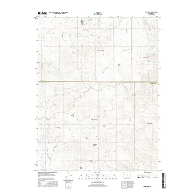
2016 Map of High Park
USGS Topo · Published 2016About this map
High Park serves as a central reference point in this high-elevation landscape where the borders of Park, Teller, and Fremont counties converge. The terrain is defined by a complex drainage system including Left Hand Cr and Fourmile Cr, punctuated by distinctive landforms such as Big Baldy and the curiously named Booger Red Hill. A network of gulches, from Espinosa Gulch to the evocative Hole in the Rock Gulch, suggests a topography shaped by intense seasonal runoff. Human activity is evidenced by the Coyote Creek Ranch Airport and a grid of roads with tribal and western-themed names like Cheyenne Rd and Outlaw Ln. The presence of Sheep Springs indicates vital water sources in the arid Bare Hills region, illustrating the challenges and adaptations of life in this interior Colorado territory.
Find a feature on this map
47 named features on this map. Tap any name to fly to it.
Don’t see what you’re looking for? This feature index may not catch every label — zoom into the map to look around manually.
Map Details
Editions of this 2016 High Park Map
This is the sole edition of this map. No revisions or reprints were ever made.
Other maps of this area

1894 · Pikes Peak
USGS Topo · 1:125,000

1901 · Pikes Peak
USGS Topo · 1:125,000

1901 · Pikes Peak
USGS Topo · 1:62,500

1942 · Cover Mtn.
USGS Topo · 1:62,500

1948 · Cover Mtn.
USGS Topo · 1:62,500

1951 · Cripple Creek South
USGS Topo · 1:24,000

1951 · Cripple Creek North
USGS Topo · 1:24,000

1954 · Cooper Mountain
USGS Topo · 1:24,000

1954 · Pueblo
USGS Topo · 1:250,000

1957 · Pueblo
USGS Topo · 1:250,000