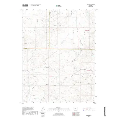
2019 Map of High Park
USGS Topo · Published 2019About this map
High Park anchors this 2019 survey, where the borders of Park, Teller, and Fremont counties converge. The landscape is defined by its complex drainage and prominent summits, featuring distinctive landmarks like Booger Red Hill and Big Baldy. A network of rural roads with names referencing regional history, such as Cherokee Trl, Apache Rd, and Sioux Rd, crisscrosses the northern half of the quadrangle. Significant water sources like Sheep Springs and Wilson Cr mark the interior, while Coyote Creek Ranch Airport provides a modern aviation waypoint among the peaks. Extensive Bureau of Land Management (BLM) holdings are detailed throughout the southern half, including BLM t5826 and BLM t5820c, reflecting the managed public nature of the high-elevation terrain near Bare Hills.
Find a feature on this map
53 named features on this map. Tap any name to fly to it.
Don’t see what you’re looking for? This feature index may not catch every label — zoom into the map to look around manually.
Map Details
Editions of this 2019 High Park Map
This is the sole edition of this map. No revisions or reprints were ever made.
Other maps of this area

1894 · Pikes Peak
USGS Topo · 1:125,000

1901 · Pikes Peak
USGS Topo · 1:125,000

1901 · Pikes Peak
USGS Topo · 1:62,500

1942 · Cover Mtn.
USGS Topo · 1:62,500

1948 · Cover Mtn.
USGS Topo · 1:62,500

1951 · Cripple Creek South
USGS Topo · 1:24,000

1951 · Cripple Creek North
USGS Topo · 1:24,000

1954 · Cooper Mountain
USGS Topo · 1:24,000

1954 · Pueblo
USGS Topo · 1:250,000

1957 · Pueblo
USGS Topo · 1:250,000