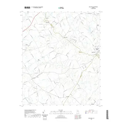
2020 Map of High Shoals
USGS Topo · Published 2020About this map
The Apalachee River serves as the winding boundary between Oconee, Walton, and Morgan counties, anchoring a rural landscape defined by historic mill sites and small agrarian settlements. Near the river's path, Snows Mill and the community of North High Shoals highlight the importance of waterpower to the region's early development. The terrain is notably marked by Turkey Creek Mtn, providing a distinct topographic rise amidst the surrounding creeks. Local aviation history is represented by the Appalachee Bluff Riverfront Airpark near Horseshoe Bend. For genealogists, the map is particularly dense with small family and church burial grounds, including the Carlton Family Cem, Locklin Cemetery, and Laboon Cem. These scattered landmarks, along with established towns like Good Hope and Bostwick, preserve the 21st-century footprint of long-standing Georgia communities.
Find a feature on this map
134 named features on this map. Tap any name to fly to it.
Don’t see what you’re looking for? This feature index may not catch every label — zoom into the map to look around manually.
Map Details
Editions of this 2020 High Shoals Map
This is the sole edition of this map. No revisions or reprints were ever made.
Other maps of this area

1896 · Monroe
USGS Topo · 1:125,000

1953 · Athens
USGS Topo · 1:250,000

1958 · Athens
USGS Topo · 1:250,000

1959 · Athens
USGS Topo · 1:250,000

1963 · Athens
USGS Topo · 1:250,000

1964 · Athens West
USGS Topo · 1:24,000

1964 · High Shoals
USGS Topo · 1:24,000

1964 · Watkinsville
USGS Topo · 1:24,000

1964 · Monroe
USGS Topo · 1:24,000

1964 · Winder South
USGS Topo · 1:24,000