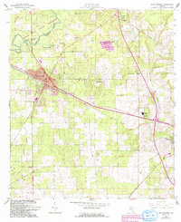
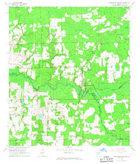
1962 Map of High Springs
USGS Topo · Published 1993About this map
The Santa Fe River winds through the northern portion of this landscape, notably disappearing underground at the Suck Hole within the O'Leno State Preserve. This unique karst topography is further evidenced by landmarks like Hornsby Spring and Columbia Spring. The town of High Springs serves as a primary hub, showing a concentrated street grid that includes S S 1st Ave and N 5th St, situated at a key junction of the Seaboard Coast Line.
Find a feature on this map
40 named features on this map. Tap any name to fly to it.
Don’t see what you’re looking for? This feature index may not catch every label — zoom into the map to look around manually.
Map Details
Editions of this 1962 High Springs Map
5 editions found
Other maps of this area

1890 · Arredondo
USGS Topo · 1:62,500

1892 · Arredondo
USGS Topo · 1:62,500

1894 · Arredondo
USGS Topo · 1:62,500

1954 · Gainesville
USGS Topo · 1:250,000

1958 · Gainesville
USGS Topo · 1:250,000

1959 · Gainesville
USGS Topo · 1:250,000

1962 · High Springs
USGS Topo · 1:24,000

1962 · Mikesville
USGS Topo · 1:24,000
1966 · Worthington Springs
USGS Topo · 1:24,000

1966 · Gainesville West
USGS Topo · 1:24,000