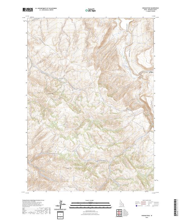
2024 Map of Higham Peak
USGS Topo · Published 2024About this map
The Blackfoot Mountains dominate this portion of Bingham County, where the topography transitions between high ridges and deeply incised creek drainages. The settlement of Alridge sits along the eastern edge of the map, positioned near where Cedar Creek meets the Blackfoot River. This area is defined by its network of high-elevation routes, including the Portneuf Presto Trail Rd and Cold Creek Trail Rd, which navigate the complex terrain surrounding prominent summits like Higham Peak and Garden Peak. Water sources are critical in this landscape, marked by features such as Cove Spring and the converging branches of North Fork Cold Creek and South Fork Cold Creek. The presence of the Little Indian Canal Rd in the northwest suggests the ongoing management of water resources for the lower-lying lands beyond the mountain front.
Find a feature on this map
22 named features on this map. Tap any name to fly to it.
Don’t see what you’re looking for? This feature index may not catch every label — zoom into the map to look around manually.
Map Details
Editions of this 2024 Higham Peak Map
This is the sole edition of this map. No revisions or reprints were ever made.
Other maps of this area

1918 · Paradise Valley
USGS Topo · 1:62,500

1924 · Ammon
USGS Topo · 1:62,500

1950 · Goshen
USGS Topo · 1:24,000

1951 · Higham Peak
USGS Topo · 1:24,000

1952 · Goshen
USGS Topo · 1:24,000

1955 · Lincoln Creek
USGS Topo · 1:24,000

1955 · Firth
USGS Topo · 1:24,000

1955 · Yandell Springs
USGS Topo · 1:62,500

1955 · Idaho Falls
USGS Topo · 1:250,000

1955 · Driggs
USGS Topo · 1:250,000