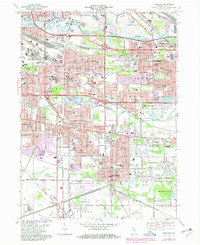
1968 Map of Highland
USGS Topo · Published 1980About this map
Industrial Northwest Indiana takes center stage in this late-1960s survey, showing the complex web of steel-belt infrastructure connecting Hammond, East Chicago, and Gary. The landscape is dominated by heavy transit corridors like the Toll Road and Tri-State Highway, alongside a dense rail network including the Conrail and Norfolk And Western. Despite this modernization, natural conservation remains visible at the Indiana Dunes National Lakeshore and the Hoosier Prairie State Nature Preserve in the southern portion of the quadrangle.
Find a feature on this map
97 named features on this map. Tap any name to fly to it.
Don’t see what you’re looking for? This feature index may not catch every label — zoom into the map to look around manually.
Map Details
Editions of this 1968 Highland Map
Other maps of this area

1892 · Calumet
USGS Topo · 1:62,500

1893 · Calumet
USGS Topo · 1:62,500

1900 · Toleston
USGS Topo · 1:62,500

1900 · Calumet
USGS Topo · 1:62,500

1901 · Calumet
USGS Topo · 1:62,500

1929 · Calumet Lake
USGS Topo · 1:24,000

1929 · Calumet City
USGS Topo · 1:24,000

1929 · Dyer
USGS Topo · 1:24,000

1930 · Dyer
USGS Topo · 1:24,000

1949 · Crete
USGS Topo · 1:62,500