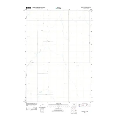
2012 Map of Highmore NE
USGS Topo · Published 2012About this map
Lost Cr provides the primary drainage for this rural Hand County landscape, winding through a grid-defined prairie environment. This 2012 survey by the U.S. Geological Survey reveals the strict North American Public Land Survey System geometry that dictates the regional transportation network. Section lines are traced by gravel and soil-surfaced roads like 340th Ave and 347th Ave, creating a repetitive five-by-five mile block structure. The scarcity of named landmarks outside of the road network and minor water features suggests a territory dedicated to large-scale agriculture and grazing. Researchers will find a preserved view of the township-and-range layout, with routes such as 183rd St and 190th St marking the bounds of the open Highmore countryside.
Find a feature on this map
15 named features on this map. Tap any name to fly to it.
Don’t see what you’re looking for? This feature index may not catch every label — zoom into the map to look around manually.
Map Details
Editions of this 2012 Highmore NE Map
This is the sole edition of this map. No revisions or reprints were ever made.
Other maps of this area

1949 · Ree Heights NW
USGS Topo · 1:24,000

1949 · Mitchell Lake
USGS Topo · 1:24,000

1950 · Highmore NE
USGS Topo · 1:24,000

1950 · Mitchell Lake
USGS Topo · 1:24,000

1950 · Highmore
USGS Topo · 1:24,000

1950 · Ree Heights
USGS Topo · 1:24,000

1950 · Highmore SE
USGS Topo · 1:24,000

1950 · Rezac Lake
USGS Topo · 1:24,000

1951 · Rice Lake
USGS Topo · 1:24,000

1951 · Ree Heights NW
USGS Topo · 1:24,000