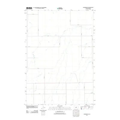
2012 Map of Highmore SE
USGS Topo · Published 2012About this map
Wolf Cr and its tributary, Little Wolf Cr, dictate the drainage patterns across this section of Hand County. This landscape is characterized by the strict geometry of the section-line road system, including North-South corridors like 340th Ave and 344th Ave, and East-West routes such as 191st St and 199th St. The southern portion of the quadrangle is bisected by Highway 14, a primary regional transit route. The terrain is marked by subtle elevation changes that direct intermittent water flow toward the larger creek beds, illustrating the agricultural character of the Great Plains where every road and waterway serves a specific purpose in the rural infrastructure.
Find a feature on this map
19 named features on this map. Tap any name to fly to it.
Don’t see what you’re looking for? This feature index may not catch every label — zoom into the map to look around manually.
Map Details
Editions of this 2012 Highmore SE Map
This is the sole edition of this map. No revisions or reprints were ever made.
Other maps of this area

1949 · Ree Heights NW
USGS Topo · 1:24,000

1949 · Mitchell Lake
USGS Topo · 1:24,000

1950 · Highmore NE
USGS Topo · 1:24,000

1950 · Mitchell Lake
USGS Topo · 1:24,000

1950 · Highmore
USGS Topo · 1:24,000

1950 · Ree Heights
USGS Topo · 1:24,000

1950 · Highmore SE
USGS Topo · 1:24,000

1951 · Ree Heights NW
USGS Topo · 1:24,000

1953 · Huron
USGS Topo · 1:250,000

1954 · Huron
USGS Topo · 1:250,000