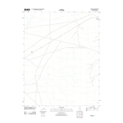
2012 Map of Hiko SE
USGS Topo · Published 2012About this map
Sixmile Flat dominates the northwestern portion of this Lincoln County landscape, showing the characteristic wide, level basin floor typical of the Great Basin. The terrain rises sharply toward the northeast at Pahroc Summit Pass, a critical topographical notch that dictates the path of regional travel. Movement through this arid region is largely defined by the corridor of Route 93, which cuts a straight line across the high desert floor before ascending the pass. The map captures a moment in the early 21st century when this area remained primarily an expanse of natural drainage patterns and sparse desert infrastructure, centered on the singular arterial connection between distant basins.
Find a feature on this map
3 named features on this map. Tap any name to fly to it.
Don’t see what you’re looking for? This feature index may not catch every label — zoom into the map to look around manually.
Map Details
Editions of this 2012 Hiko SE Map
This is the sole edition of this map. No revisions or reprints were ever made.
Other maps of this area
1885 · Pioche
USGS Topo · 1:250,000
1886 · Pioche
USGS Topo · 1:250,000
1945 · Alamo
USGS Topo · 1:125,000

1954 · Caliente
USGS Topo · 1:250,000
1959 · Caliente
USGS Topo · 1:250,000
1969 · Alamo NE
USGS Topo · 1:24,000
1969 · Delamar NW
USGS Topo · 1:24,000
1969 · Ash Springs
USGS Topo · 1:24,000
1970 · Hiko NE
USGS Topo · 1:24,000
1970 · Pahroc Summit Pass
USGS Topo · 1:24,000