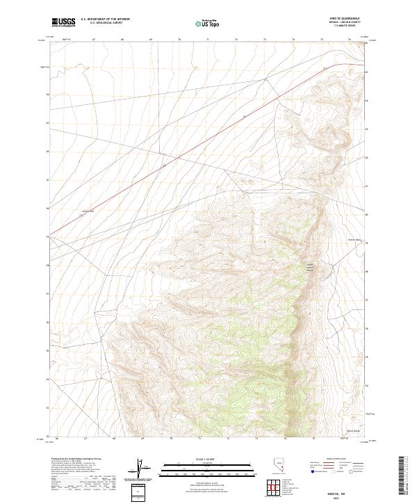
2021 Map of Hiko SE
USGS Topo · Published 2021About this map
South Pahroc Range and the wider Pahroc Range dominate the eastern topography of this Lincoln County survey, providing a detailed look at the basin-and-range geography of the Great Basin. The terrain drops sharply into the expansive Sixmile Flat to the west and the Pahroc Valley to the east, illustrating a classic Nevada landscape of high ridges separated by broad, dry basins. Modern infrastructure is represented by Highway 93, which cuts diagonally through the northern townships. The map highlights the intersection of public land survey sections, including t4s r62e and t5s r62e, which define the administrative grid across these remote highlands. For researchers, this document captures the exact contour of the mountain flanks and the primitive trackways that navigate the edges of the flat valley floors.
Find a feature on this map
9 named features on this map. Tap any name to fly to it.
Don’t see what you’re looking for? This feature index may not catch every label — zoom into the map to look around manually.
Map Details
Editions of this 2021 Hiko SE Map
This is the sole edition of this map. No revisions or reprints were ever made.
Other maps of this area

1885 · Pioche
USGS Topo · 1:250,000

1886 · Pioche
USGS Topo · 1:250,000

1945 · Alamo
USGS Topo · 1:125,000

1954 · Caliente
USGS Topo · 1:250,000

1959 · Caliente
USGS Topo · 1:250,000

1969 · Alamo NE
USGS Topo · 1:24,000

1969 · Delamar NW
USGS Topo · 1:24,000

1969 · Ash Springs
USGS Topo · 1:24,000

1970 · Hiko NE
USGS Topo · 1:24,000
1970 · Pahroc Summit Pass
USGS Topo · 1:24,000