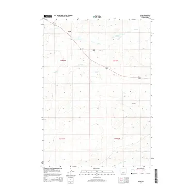
2015 Map of Hiland
USGS Topo · Published 2015About this map
Hiland serves as the primary landmark in this high-plains landscape of Natrona County, where water management is the defining human footprint. The map documents an extensive network of small reservoirs designed to capture seasonal runoff in an arid environment, including Hiland Reservoir, Burke Reservoir, and the Dead Horse Reservoir. This reliance on collected water is underscored by the drainage patterns of Poison Cr and the S Fork Powder River, which carve through the terrain near topographical features like Needles Eye Butte and Sand Draw. The alignment of 20 26 provides the main corridor for transport, cutting diagonally across the township and range lines. The concentration of named catchments such as Adobe Reservoir and Wolton Reservoir highlights the critical importance of water rights and infrastructure for livestock and land use in central Wyoming during the early 21st century.
Find a feature on this map
18 named features on this map. Tap any name to fly to it.
Don’t see what you’re looking for? This feature index may not catch every label — zoom into the map to look around manually.
Map Details
Editions of this 2015 Hiland Map
This is the sole edition of this map. No revisions or reprints were ever made.
Other maps of this area

1952 · Arminto
USGS Topo · 1:24,000

1952 · Arminto SW
USGS Topo · 1:24,000

1952 · Arminto NW
USGS Topo · 1:24,000

1952 · Waltman NW
USGS Topo · 1:24,000

1952 · Waltman
USGS Topo · 1:24,000

1952 · Hiland
USGS Topo · 1:24,000

1952 · Ervay Basin
USGS Topo · 1:24,000

1955 · Arminto
USGS Topo · 1:250,000

1955 · Casper
USGS Topo · 1:250,000

1958 · Casper
USGS Topo · 1:250,000