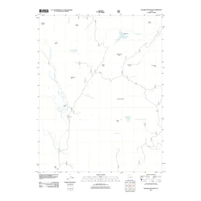
2011 Map of Hilgard Mountain
USGS Topo · Published 2011About this map
Hilgard Mountain stands as the central landmark of this high-elevation landscape in Sevier County, where a network of remote forest service roads and water management features defines the terrain. The presence of Sheep Valley Reservoir and Willies Flat Reservoir indicates the critical role of water storage in this arid upland region. The topography is shaped by significant peaks and plateaus, including Windstorm Peak and the expansive U M Plateau, which overlook the headwaters of several drainage systems. Historically, these areas like Water Flat and Willies Flat have served as markers for local navigation and ranching. The map details numerous named crossings and gaps, such as Yens Peters Gap and the U M Yogo Saddle, providing a clear picture of the natural corridors used to traverse this portion of the Fishlake National Forest area at the start of the twenty-first century.
Find a feature on this map
51 named features on this map. Tap any name to fly to it.
Don’t see what you’re looking for? This feature index may not catch every label — zoom into the map to look around manually.
Map Details
Editions of this 2011 Hilgard Mountain Map
This is the sole edition of this map. No revisions or reprints were ever made.
Other maps of this area

1885 · Fish Lake
USGS Topo · 1:250,000

1896 · Fish Lake
USGS Topo · 1:250,000

1922 · Emery No.3
USGS Topo · 1:31,680

1925 · Acord Lakes
USGS Topo · 1:62,500

1956 · Salina
USGS Topo · 1:250,000

1960 · Salina
USGS Topo · 1:250,000

1962 · Salina
USGS Topo · 1:250,000

1966 · Yogo Creek
USGS Topo · 1:24,000
1966 · Gooseberry Creek
USGS Topo · 1:24,000

1968 · Johns Peak
USGS Topo · 1:24,000