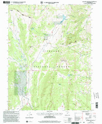
2001 Map of Hilgard Mountain
USGS Topo · Published 2003About this map
Fishlake National Forest dominates this high-altitude landscape in Sevier County, where complex drainage patterns define the central Utah highlands. The terrain is marked by significant topographical landmarks such as Hilgard Mountain and Windstorm Peak, with the high U M Plateau and Sheep Valley forming the primary geographic axis. Water management is evident through high-country features like Sheep Valley Reservoir and Willies Flat Reservoir, which capture runoff from the surrounding ridges. Local nomenclature reflects the area's pioneer and ranching heritage, seen in names like Yens Peters Gap, Red Creek Hole, and Black Flat. The hydrology is particularly intricate in the west, where The Potholes feed into UM Creek, while the eastern slopes drain through North Fork Clear Creek and North Last Chance Cr.
Find a feature on this map
38 named features on this map. Tap any name to fly to it.
Don’t see what you’re looking for? This feature index may not catch every label — zoom into the map to look around manually.
Map Details
Editions of this 2001 Hilgard Mountain Map
This is the sole edition of this map. No revisions or reprints were ever made.
Other maps of this area

1885 · Fish Lake
USGS Topo · 1:250,000

1896 · Fish Lake
USGS Topo · 1:250,000

1922 · Emery No.3
USGS Topo · 1:31,680

1925 · Acord Lakes
USGS Topo · 1:62,500

1956 · Salina
USGS Topo · 1:250,000

1960 · Salina
USGS Topo · 1:250,000

1962 · Salina
USGS Topo · 1:250,000

1966 · Yogo Creek
USGS Topo · 1:24,000
1966 · Gooseberry Creek
USGS Topo · 1:24,000

1968 · Johns Peak
USGS Topo · 1:24,000