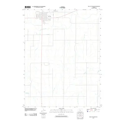
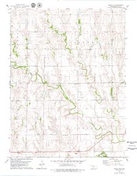
2010 Map of Hill City South
USGS Topo · Published 2010About this map
Hill City sits at the northern edge of this Kansas landscape, serving as a primary point of settlement where the grid of city streets like Mc Vey St and S 2nd Ave meets the open agricultural plains. The geography is defined by a dense network of drainage systems that flow southward from the South Fork Solomon River. These waterways, including Coon Creek and Brush Creek, create a distinct dendritic pattern across the terrain, illustrating the natural irrigation and erosion paths that have shaped Graham County land use.
Find a feature on this map
13 named features on this map. Tap any name to fly to it.
Don’t see what you’re looking for? This feature index may not catch every label — zoom into the map to look around manually.
Map Details
Editions of this 2010 Hill City South Map
This is the sole edition of this map. No revisions or reprints were ever made.
Other maps of this area

1893 · Hill
USGS Topo · 1:125,000

1955 · Beloit
USGS Topo · 1:250,000

1959 · Beloit
USGS Topo · 1:250,000

1979 · Bogue
USGS Topo · 1:24,000

1979 · Hill City South
USGS Topo · 1:24,000

1979 · Penokee
USGS Topo · 1:24,000
1979 · Hay Hollow
USGS Topo · 1:24,000
1979 · Hill City NW
USGS Topo · 1:24,000
1979 · Hill City 4 NW
USGS Topo · 1:24,000
1979 · Bogue NW
USGS Topo · 1:24,000