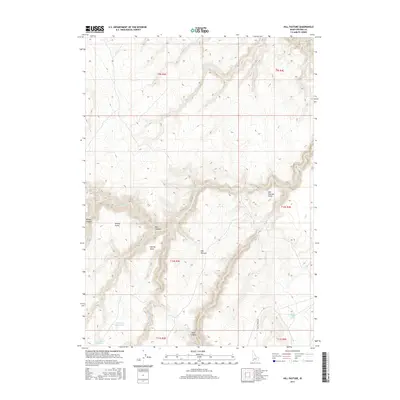
2017 Map of Hill Pasture
USGS Topo · Published 2017About this map
Hill Pasture defines this corner of Owyhee County, where the high plateaus of southwestern Idaho are carved by a complex network of canyons and seasonal drainages. The landscape is characterized by prominent overlooks such as Hill Pasture Point, Willies Point, and Harvey Point, which provide vantage points over the deep incisions of Dry Canyon and Zeno Canyon. Water management is central to the area's utility, evidenced by Harveys V Reservoir and Dry Canyon Reservoir, alongside natural sources like Hicks Springs and Jimmy Cappel Spring. These features suggest a history of livestock grazing and rangeland use, supported by the remote Battle Creek Rd. The map tracks the winding course of Big Jacks Cr and Duncan Cr as they navigate the sharp elevation changes of this high-desert terrain.
Find a feature on this map
22 named features on this map. Tap any name to fly to it.
Don’t see what you’re looking for? This feature index may not catch every label — zoom into the map to look around manually.
Map Details
Editions of this 2017 Hill Pasture Map
This is the sole edition of this map. No revisions or reprints were ever made.
Other maps of this area

1955 · Jordan Valley
USGS Topo · 1:250,000

1955 · Twin Falls
USGS Topo · 1:250,000

1956 · Big Hill
USGS Topo · 1:62,500

1957 · Jordan Valley
USGS Topo · 1:250,000

1958 · Twin Falls
USGS Topo · 1:250,000

1958 · Jordan Valley
USGS Topo · 1:250,000
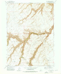
1972 · Hill Pasture
USGS Topo · 1:24,000

1972 · Wickahoney Point
USGS Topo · 1:24,000

1972 · Turner Table
USGS Topo · 1:24,000
1972 · Big Horse Basin Gap
USGS Topo · 1:24,000