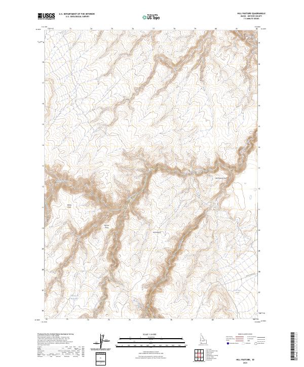
2023 Map of Hill Pasture
USGS Topo · Published 2023About this map
Big Jacks Creek Wilderness encompasses much of this Idaho landscape, where high plateaus are bisected by deep drainage systems. The hydrologic network is central to the area's character, featuring several federally protected waterways including the Cottonwood Creek Wild and Scenic River, the Duncan Creek Wild and Scenic River, and the Wickahoney Creek Wild and Scenic River. These canyons provide a stark contrast to the surrounding flats of Hill Pasture.
Find a feature on this map
26 named features on this map. Tap any name to fly to it.
Don’t see what you’re looking for? This feature index may not catch every label — zoom into the map to look around manually.
Map Details
Editions of this 2023 Hill Pasture Map
This is the sole edition of this map. No revisions or reprints were ever made.
Other maps of this area

1955 · Jordan Valley
USGS Topo · 1:250,000

1955 · Twin Falls
USGS Topo · 1:250,000

1956 · Big Hill
USGS Topo · 1:62,500

1957 · Jordan Valley
USGS Topo · 1:250,000

1958 · Twin Falls
USGS Topo · 1:250,000

1958 · Jordan Valley
USGS Topo · 1:250,000
1972 · Hill Pasture
USGS Topo · 1:24,000

1972 · Wickahoney Point
USGS Topo · 1:24,000

1972 · Turner Table
USGS Topo · 1:24,000
1972 · Big Horse Basin Gap
USGS Topo · 1:24,000