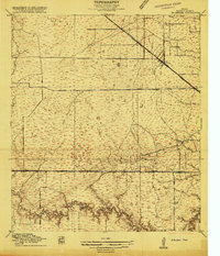
1915 Map of Hillendahl
USGS Topo · Published 1915About this map
Hillendahl and the surrounding Harris County prairie are captured here during a period of early twentieth-century rural development. The landscape is defined by a network of drainage ways and bayous, most notably the meandering course of Buffalo Bayou at the southern edge and Horsepen Slough. Transportation corridors dominate the settlement pattern, with the Houston Missouri Kansas and Texas railroad cutting a straight line across the plains.
Find a feature on this map
23 named features on this map. Tap any name to fly to it.
Don’t see what you’re looking for? This feature index may not catch every label — zoom into the map to look around manually.
Map Details
Editions of this 1915 Hillendahl Map
3 editions found
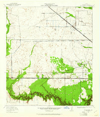
Other maps of this area

1915 · Bellaire
USGS Topo · 1:24,000

1915 · Houston Heights
USGS Topo · 1:24,000

1915 · Alief
USGS Topo · 1:24,000

1915 · Cypress
USGS Topo · 1:24,000

1915 · Addicks
USGS Topo · 1:24,000

1915 · Hillendahl
USGS Topo · 1:24,000

1915 · Clodine
USGS Topo · 1:24,000

1916 · Aldine
USGS Topo · 1:24,000

1916 · Satsuma
USGS Topo · 1:24,000

1918 · Cypress
USGS Topo · 1:31,680
Featured Places
- Houston, TX
- Jersey Village, TX
- Hunters Creek Village, TX
- Bunker Hill Village, TX
- Spring Valley Village, TX