
1915 Map of Hillendahl
USGS Topo · Published 1915About this map
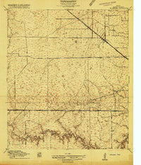
Hillendahl and Fairbanks serve as the primary nodes of activity in this 1915 Harris County landscape, which is defined by a dense network of watercourses and early rail lines. The surveying work of Buffalo Bayou and Horsepen Slough reveals the intricate drainage patterns west of Houston before modern urbanization. Education and community life are anchored by the Hillendahl School and Spring Branch School, positioned near the developing road networks like Point Road and Jeannetta Road. Transportation is dominated by two major rail corridors: the Houston and Texas Central and the Houston Missouri Kansas and Texas. The map captures a transition point in Texas history where agricultural land began to yield to regional connectivity, evidenced by the intersection of rural tracks and the notable Katy Cut Off Road.
Find a feature on this map
15 named features on this map. Tap any name to fly to it.
Don’t see what you’re looking for? This feature index may not catch every label — zoom into the map to look around manually.
Map Details
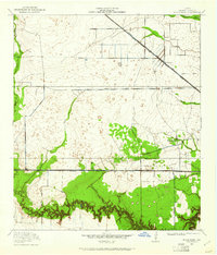
Editions of this 1915 Hillendahl Map
3 editions found
Other maps of this area

1915 · Bellaire
USGS Topo · 1:24,000

1915 · Houston Heights
USGS Topo · 1:24,000

1915 · Alief
USGS Topo · 1:24,000

1915 · Cypress
USGS Topo · 1:24,000

1915 · Addicks
USGS Topo · 1:24,000

1915 · Clodine
USGS Topo · 1:24,000

1916 · Aldine
USGS Topo · 1:24,000

1916 · Satsuma
USGS Topo · 1:24,000

1918 · Cypress
USGS Topo · 1:31,680

1918 · Addicks
USGS Topo · 1:31,680
Featured Places
- Houston, TX
- Jersey Village, TX
- Hunters Creek Village, TX
- Bunker Hill Village, TX
- Spring Valley Village, TX