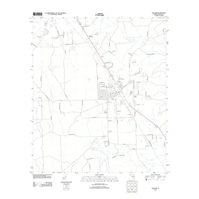
2012 Map of Hilliard
USGS Topo · Published 2012About this map
The Little Saint Marys River meanders across the northeast corner of this landscape, anchoring a drainage network that includes Pigeon Cr and Mills Cr. The settlement of Andrews sits to the north, while the larger town center features a concentrated grid of streets such as Georgia St and Oak St. This region of Nassau County is defined by its transition between low-lying wetland features like Buford Bay and the organized infrastructure supporting local transport and aviation at the Hilliard Airpark. For those researching family history in the area, the map provides precise locations for both Oakwood Cem and Saint Theresa Cem. The layout of the road network, including Co RD 121 and the Di Hi Way, illustrates the connectivity of this north Florida community in the early 21st century.
Find a feature on this map
106 named features on this map. Tap any name to fly to it.
Don’t see what you’re looking for? This feature index may not catch every label — zoom into the map to look around manually.
Map Details
Editions of this 2012 Hilliard Map
This is the sole edition of this map. No revisions or reprints were ever made.
Other maps of this area

1917 · Boulogne
USGS Topo · 1:62,500

1917 · Hilliard
USGS Topo · 1:62,500

1918 · Folkston
USGS Topo · 1:62,500

1918 · Moniac
USGS Topo · 1:62,500

1919 · Hilliard
USGS Topo · 1:62,500

1919 · Boulogne
USGS Topo · 1:62,500

1942 · Moniac
USGS Topo · 1:62,500

1948 · Jacksonville
USGS Topo · 1:250,000

1954 · Valdosta
USGS Topo · 1:250,000

1957 · Jacksonville
USGS Topo · 1:250,000