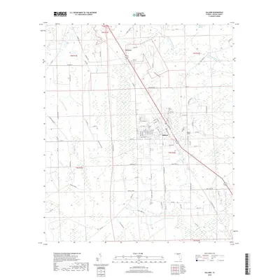
2018 Map of Hilliard
USGS Topo · Published 2018About this map
Hilliard serves as the central hub of this northern Nassau County landscape, where the grid of town streets meets the winding waters of the Little Saint Marys River. To the north, the smaller settlement of Andrews sits along the roadway, while the surrounding territory is defined by an extensive network of wetlands, including Cabbage Swamp, Buford Bay, and Little Boggy Swamp. This 2018 survey reveals a rural economy shaped by both timber and transport, evidenced by landmarks like the Hilliard Airpark and the numerous family-named routes such as Murrhee Rd and Leon Haddock Rd. Local history and genealogy are anchored by Saint Theresa Cem and Oakwood Cem, located just northeast of the town center. The map also traces the path of Mills Cr and Little Boggy Cr, illustrating the complex drainage patterns that characterize this portion of the Florida Panhandle's eastern reaches.
Find a feature on this map
101 named features on this map. Tap any name to fly to it.
Don’t see what you’re looking for? This feature index may not catch every label — zoom into the map to look around manually.
Map Details
Editions of this 2018 Hilliard Map
This is the sole edition of this map. No revisions or reprints were ever made.
Other maps of this area

1917 · Boulogne
USGS Topo · 1:62,500

1917 · Hilliard
USGS Topo · 1:62,500

1918 · Folkston
USGS Topo · 1:62,500

1918 · Moniac
USGS Topo · 1:62,500

1919 · Hilliard
USGS Topo · 1:62,500

1919 · Boulogne
USGS Topo · 1:62,500

1942 · Moniac
USGS Topo · 1:62,500

1948 · Jacksonville
USGS Topo · 1:250,000

1954 · Valdosta
USGS Topo · 1:250,000

1957 · Jacksonville
USGS Topo · 1:250,000