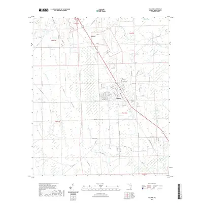
2021 Map of Hilliard
USGS Topo · Published 2021About this map
Hilliard serves as the central hub of this Nassau County landscape, where the local street grid meets the aviation facilities of the Hilliard Airpark. The surrounding terrain is defined by a complex network of wetlands and watercourses, including the Little Saint Marys River in the northeast and the expansive Little Boggy Swamp to the southeast. To the north, the small settlement of Andrews sits along the rail corridor, while numerous family-named roads like Sundberg Rd and Murrhee Rd spider out into the pine woods and cypress strands. Genealogists will find the local burial grounds of Saint Theresa Cem and Oakwood Cem situated just north of the town center. The map illustrates a community shaped by its hydrology, with features like Buford Bay and Cabbage Swamp dictating the placement of timber lands and rural homesteads.
Find a feature on this map
99 named features on this map. Tap any name to fly to it.
Don’t see what you’re looking for? This feature index may not catch every label — zoom into the map to look around manually.
Map Details
Editions of this 2021 Hilliard Map
This is the sole edition of this map. No revisions or reprints were ever made.
Other maps of this area

1917 · Boulogne
USGS Topo · 1:62,500

1917 · Hilliard
USGS Topo · 1:62,500

1918 · Folkston
USGS Topo · 1:62,500

1918 · Moniac
USGS Topo · 1:62,500

1919 · Hilliard
USGS Topo · 1:62,500

1919 · Boulogne
USGS Topo · 1:62,500

1942 · Moniac
USGS Topo · 1:62,500

1948 · Jacksonville
USGS Topo · 1:250,000

1954 · Valdosta
USGS Topo · 1:250,000

1957 · Jacksonville
USGS Topo · 1:250,000